“Invisible Killer” on Route 315: Dense Fog and Black Ice Trigger Monday Morning Commuter Alert in Columbus
At Brainx, we believe…
This development highlights the deceptive and often dangerous nature of the “false spring” transition. At Brainx, we believe the combination of washed-away road salt and freezing overnight temperatures creates a “perfect storm” for black ice—an invisible hazard that claims lives every year. This weather report isn’t just a suggestion to grab a coat; it is a critical warning for every driver in Central Ohio to fundamentally alter their morning routine or risk disaster on the asphalt.
The News: A Treacherous Start to a Mild Week
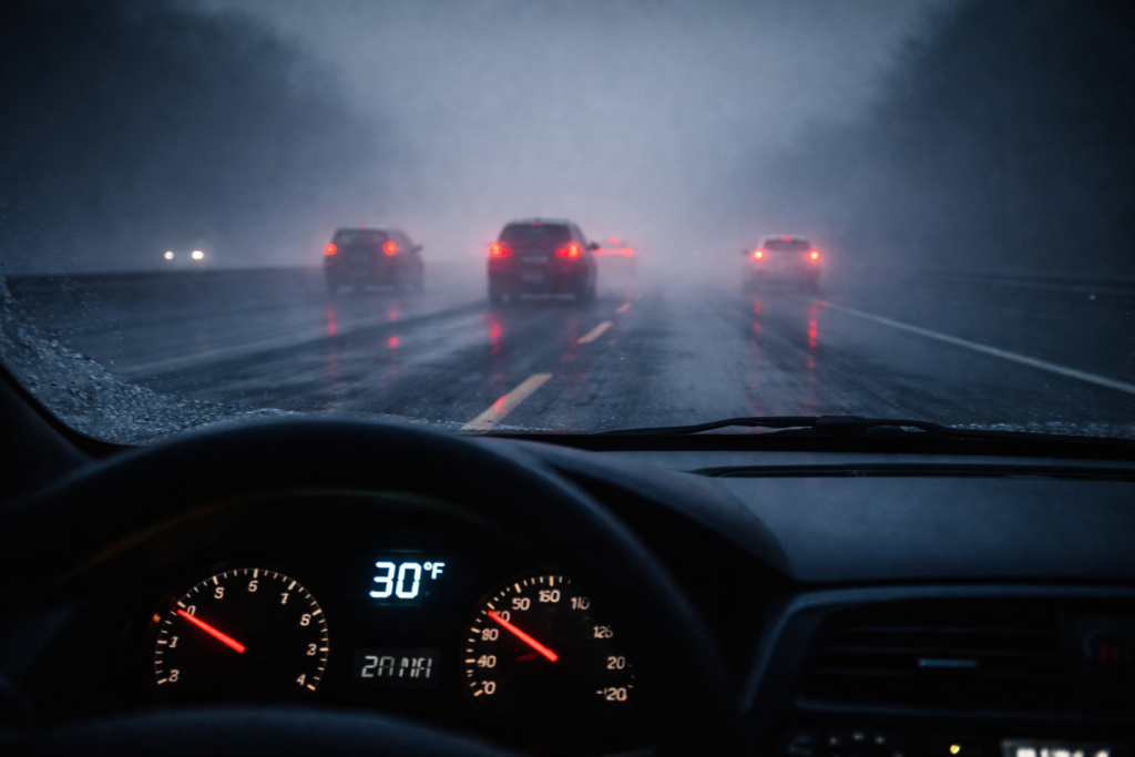
Columbus residents are waking up to a deceptive Monday morning. While the forecast promises unseasonably mild temperatures reaching into the 50s and 60s later this week, the immediate reality is a hazardous mix of dense fog and black ice. The National Weather Service and local meteorologists have issued urgent advisories effective until 11 AM, warning that the morning commute could be treacherous.
The “Salt Wash” Phenomenon The primary danger this morning stems from yesterday’s rainfall.
- The Cause: Sunday’s rain effectively “scrubbed” the roads clean, washing away the residual salt and brine that road crews had applied during previous storms.
- The Freeze: As temperatures dipped into the low 30s overnight, that lingering moisture on the pavement froze into a thin, transparent layer of ice—known as black ice.
- The Danger Zones: Unlike snow, this ice is invisible. It is most prevalent on bridges, overpasses, and shaded areas of parking lots and sidewalks.
Monday’s Forecast Breakdown (Feb 16, 2026):
- Morning: A Dense Fog Advisory is in effect for most of Ohio until 11 AM. Visibility is reduced to less than a quarter-mile in many spots. Drivers are urged to use low beams and increase following distance.
- Afternoon: The fog will burn off by midday, revealing partly cloudy skies. Temperatures will rebound significantly, reaching a high of 52°F.
- Wind: Light south winds will help usher in the warmer air mass.
The Week Ahead: A Rollercoaster of Seasons Central Ohio is about to experience a classic “February Thaw” followed by a sharp return to reality.
- Tuesday: Another foggy start is likely, followed by mostly cloudy skies and a high of 56°F.
- Wednesday (The Peak): This will be the warmest day of the week, with highs soaring to near 64°F. However, it comes with a price: gusty southwest winds (15–20 mph) and scattered rain showers, potentially even a rumble of thunder.
- Thursday: The warmth lingers (High 62°F), but wet weather intensifies. Expect scattered showers during the day, transitioning to heavy rain overnight into Friday morning.
- Friday: A wet and windy end to the work week. Early heavy rain will taper off, but winds could gust over 25 mph. Highs will dip slightly to 58°F.
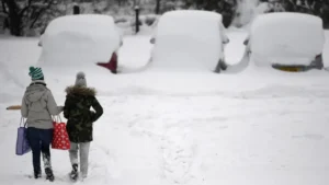
- The Weekend Drop: The mild spell ends abruptly. Saturday brings cooler temps (46°F) and showers, while Sunday threatens a return to winter with a high of only 39°F and a chance of a “wintry mix.”
Deep Dive: The Science of Black Ice & Fog Safety
(Analysis for Brainx Ultimate Readers)
Why Black Ice is Deadlier than Snow Black ice forms without bubbles, allowing the road surface to be seen through it. This transparency makes it look like a harmless wet patch. When a vehicle hits black ice, there is zero friction. The “wash-off” event described in this forecast is particularly dangerous because drivers assume the roads are treated.
- Safety Tip: If you hit black ice, do not brake. Lift your foot off the gas and steer gently in the direction you want to go. Overcorrecting causes spin-outs.
The Mechanics of Advection Fog The dense fog blanketing Columbus is likely “advection fog.” This occurs when warm, moist air (moving in from the south on those light winds) passes over the cold, snow-chilled ground of Ohio. The air cools to its dew point immediately upon contact with the cold surface, condensing into a thick cloud at ground level. This type of fog is persistent and can linger until the wind picks up or the sun heats the ground sufficiently.
Infrastructure Impact The rapid freeze-thaw cycle predicted this week (30s to 60s and back to 30s) is brutal on infrastructure. This expansion and contraction of moisture in pavement cracks is the primary cause of potholes. Columbus drivers should expect deteriorating road conditions and new potholes emerging on I-70 and I-270 by next week.
Why It Matters
For the common man, this forecast is a disruption to the biological and mechanical rhythm of daily life. The erratic temperature swings can wreak havoc on immune systems (increasing susceptibility to colds/flu) and vehicle maintenance (tire pressure fluctuations). More importantly, the black ice threat this morning is a life-safety issue. It matters because a split-second loss of traction on the I-670 ramp can change a family’s life forever. This weather pattern serves as a reminder that in the Midwest, “spring” is often just a trap set by winter.


Leave a Reply